
Buyer Guide
North Lake Lanier homes are waterfront, lake-access, and lake-view properties on the northern half of Lake Lanier, primarily in Gainesville and Hall County on the east, the Chestatee River arm running northwest into Dawson County, and the Dawsonville shoreline above Browns Bridge. This segment of the lake trades a quieter, lower-density character against a longer commute to metro Atlanta than the south-lake Buford and Cumming corridor. Buyers should expect deeper coves on the Chestatee arm, attendance splits between Gainesville City Schools, Hall County Schools, and Dawson County Schools, and a healthcare-anchored economy centered on Northeast Georgia Medical Center.
North Lake Lanier Lifestyle
North Lake Lanier lifestyle is a quieter, lower-density experience than the south-lake corridor, anchored by Gainesville's role as the lake's city of record, the Chestatee River arm's deeper coves, and a steady but longer commute to metro Atlanta. The three forces that shape day-to-day life on the north end are water-traffic patterns, North Georgia outdoor access, and a built environment that leans toward retreat-scale parcels rather than dense subdivisions.
Quieter water, retreat feel, and North Georgia access
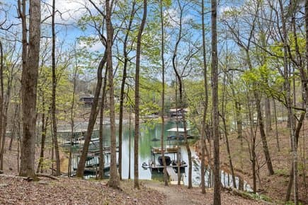
The north half of Lake Lanier carries measurably less boat traffic than the south end on summer weekends. Buford Dam at the lake's southern terminus concentrates the heaviest recreational use within the Cumming, Buford, and Flowery Branch coves closest to the dam and to the GA-400 / I-985 split. The Chestatee River arm, the Gainesville east-shore coves, and the Dawsonville segment above Browns Bridge sit farther from that traffic core, and cove cross-sections widen rather than narrow as the shoreline moves north, which dilutes wake density. The retreat character extends beyond the water. North Hall County and Dawson County still hold larger parcels — three- to ten-acre estate lots are not unusual within a short drive of the shoreline — and the dominant built environment is single-family lake-access and waterfront rather than the higher-density townhome and small-lot subdivision pattern more typical of Forsyth and southern Hall County. North Georgia recreational anchors are part of the lifestyle: Don Carter State Park, the only state park directly on Lake Lanier, sits at the lake's north end on Clarks Bridge Road; Amicalola Falls State Park and the southern terminus of the Appalachian Trail at Springer Mountain are roughly a 35- to 50-minute drive northwest through Dawsonville.
Gainesville, Dawsonville, river arms, and quiet coves
North Lake Lanier covers four working sub-markets. The Gainesville east-shore segment runs from the Lanier Bridge near Jesse Jewell Parkway north through the Lake Lanier Olympic Park area on Clarks Bridge Road; this is the lake's administrative core, with the U.S. Army Corps of Engineers, Mobile District headquarters on Buford Dam Road and the Northeast Georgia Health System flagship hospital a short drive inland. The Chestatee River arm runs northwest from Browns Bridge through Hall and Dawson counties and holds some of the lake's deepest cove configurations at winter pool elevation, which is a recurring filter for buyers shopping for wakeboat-capable parcels. The Dawsonville shoreline above Browns Bridge sits in Dawson County and prices off the GA-400 corridor toward Cumming and Alpharetta rather than the I-985 corridor toward Gainesville. The fourth sub-market is the northern Hall County shoreline near Don Carter State Park and the Wahoo Creek arm, which trends lower density and longer parcels. Marina access on the north end runs through Aqualand Marina, Holiday Marina, and Bald Ridge Marina; lake-access neighborhoods like Sunrise Cove and Cresswind at Lake Lanier serve the mid-tier on the Gainesville side.
How North Lake differs from the South Lake corridor
North Lake Lanier differs from the south-lake corridor on five reliable variables: commute distance to Atlanta, water-traffic density, cove geometry, school district structure, and price band. The south-lake Buford and Cumming segments sit roughly 35 to 45 miles from downtown Atlanta and run 50- to 70-minute drive times off-peak; the Gainesville and Dawsonville north-shore segments sit 55 to 70 miles north of downtown Atlanta and routinely run 90-plus minutes during commute hours via I-985 or GA-400. Water traffic concentrates near Buford Dam on summer weekends and thins moving north into the Chestatee arm and the Wahoo Creek area. Cove geometry on the Chestatee River arm tends to run deeper at winter pool than several of the shallow south-lake fingers, which matters for year-round wakeboat usability. School district structure differs too: the south lake overlaps Forsyth County Schools and Gwinnett County Public Schools plus the small Buford City Schools zone, while the north lake overlaps Gainesville City Schools, Hall County Schools, and Dawson County Schools. Comparable dock-permitted lakefront on the north end generally clears below south-lake benchmarks for similar cove and dock configurations, reflecting the longer Atlanta commute.
Property Types on North Lake Lanier
Property types on North Lake Lanier span four working tiers: true private-dock lakefront, lake-access community homes, golf community and acreage retreats, and a second-home and rental-investment segment that follows the lake's seasonal calendar. The mix tilts toward lower-density and retreat-scale parcels relative to the south lake.
Private dock homes, quiet coves, and larger retreat properties
True private-dock lakefront on the north end carries a transferable U.S. Army Corps of Engineers shoreline-use permit attached to a single parcel. Single-slip and double-slip configurations dominate; party-dock permits exist but remain capped by cove width and shoreline-density limits set under the Corps shoreline-use plan. The Chestatee River arm holds a higher concentration of deep-water cove parcels than the Gainesville east-shore segment, and the luxury tier — homes with double-slip docks, deep cove access, and finishes priced above $1.5 million — concentrates along Chestatee coves and the deeper north-Hall fingers. Retreat-scale parcels are a defining feature of the north end. Three- to ten-acre lakefront and lake-adjacent estates are available within a short drive of Dawsonville, northern Hall County, and the Wahoo Creek arm, a configuration that is rare on the south lake where parcels are smaller and infill is denser. Waterfront homes on Lake Lanier with a transferable Corps of Engineers dock permit posted a median sale price of approximately $1,250,000 as of March 2026 (Georgia MLS, ZIP codes 30518, 30519, 30506, 30542, and 30040).
Lake-access communities, golf communities, and acreage options
Lake-access communities make up a steady share of north-end inventory. Sunrise Cove and Cresswind at Lake Lanier on the Gainesville side provide community-dock arrangements and amenity-anchored daily life without parcel-line shoreline; Cresswind is an age-targeted 55-plus community with single-level and main-level-primary floor plans. Chestatee Golf Club in Dawsonville anchors a golf-community option on the Chestatee River arm, pairing fairway lots with proximate lake access. Acreage and unrestricted lots are still attainable in north Hall County and Dawson County in a way that is difficult inside the Forsyth and Gwinnett south-lake footprint. Lake-access homes on the Gainesville north shore — including Sunrise Cove and Cresswind at Lake Lanier — posted a median sale price of approximately $625,000 as of March 2026 (Georgia MLS, ZIP codes 30506 and 30501), and Hall County overall inventory averaged 2.6 months of supply (Georgia MLS, April 2026 report), a seller-leaning balance by historical standards. The acreage segment trades on parcel size, road frontage, and septic capacity rather than dock class.
Second homes, STR prospects, retirement homes, and local move-up properties
Second-home and weekend-use buyers concentrate on the Chestatee River arm and the Dawsonville segment, valuing the quieter water and the longer parcels. Short-term rental prospects vary by jurisdiction: Hall County, Dawson County, and the City of Gainesville each maintain their own short-term rental ordinances, occupancy limits, and lodging-tax rules, and the rule set should be verified with the relevant jurisdiction before a purchase is underwritten on STR cash flow. Retirement buyers concentrate in Cresswind at Lake Lanier and similar single-level lake-access neighborhoods, and the Gainesville waterfront market draws a measurable clinician cohort tied to Northeast Georgia Medical Center. Local move-up buyers — Hall County and Dawson County families upgrading from interior subdivisions to a lake-access or true lakefront home — make up a steadier share of north-end transactions than they do on the south lake, where Atlanta-commuter and second-home buyers dominate. That mix smooths the seasonal pacing, but March-through-June listings still transact more quickly than fall and winter listings, mirroring the broader Lake Lanier pattern.
Buyer and Seller Strategy
Buying or selling a North Lake Lanier home requires underwriting the Corps shoreline-use permit, the cove geometry at winter pool, the school attendance line, and a longer Atlanta commute than the south-lake comparables. The strategy points below are the ones that consistently surface in north-end walkthroughs and listing prep.
Water depth, cove location, septic, and road access
Four physical variables drive long-run usability on the north end: water depth at winter pool, cove orientation, septic capacity, and the access road to the parcel. Cove depth should be measured at winter pool — approximately 1,070 feet, with drought years historically dropping into the 1,060–1,065 range — rather than at full pool of 1,071 feet, because winter pool determines whether a wakeboat or pontoon stays in the water through drought cycles like those Lake Lanier experienced in 2007 and 2012. The Chestatee River arm generally holds deeper water at the dock end than the shallow north-Hall fingers near Wahoo Creek. Septic capacity is the variable most commonly overlooked. Many original 1970s and 1980s lakefront cottages on the Gainesville east shore and the Chestatee arm were built on three-bedroom septic fields that will not support a planned four- or five-bedroom rebuild without a new perc test and a relocated drainfield through the Hall County or Dawson County environmental health office. Road access matters too: several Chestatee coves and northern Hall County parcels sit at the end of gravel or shared private roads, which affects insurance, school-bus pickup, and emergency response time from Northeast Georgia Medical Center and the nearest fire and EMS stations.
Pricing privacy, retreat value, and dock usability
Pricing a North Lake Lanier home starts with the dock permit, the cove, and the privacy of the parcel — not the kitchen finishes. A current, transferable Corps of Engineers permit with a single- or double-slip configuration and a gangway that meets shoreline-use plan limits represents the floor of the lakefront premium. Privacy and parcel size carry a measurable additional premium on the north end that they do not carry to the same extent on the dense south lake; wooded buffer, road setback, and tree cover are part of the price stack. Dock usability layers on next. South- and west-facing shorelines hold afternoon sun and longer usable hours on the water. Cove depth, gangway slope, and the presence of any Corps-permitted bank stabilization affect both insurability and resale. As of March 2026, comparable Hall County north-shore dock-permitted lakefront generally cleared below Cumming and Buford benchmarks for similar dock and cove configurations (Georgia MLS, April 2026 report), reflecting the longer Atlanta commute rather than any dock-quality difference. For acreage-scale retreats off the immediate shoreline, comparables shift to parcel size, road frontage, and view rather than slip count.
Schedule a North Lake Lanier consultation
A North Lake Lanier consultation prepared by a local agent and brokerage starts with the buyer or seller's sub-market — Gainesville east shore, Chestatee River arm, Dawsonville above Browns Bridge, or northern Hall County near Don Carter State Park. From there, the analysis layers in the relevant Corps shoreline-use map, the assigned school district under Gainesville City Schools, Hall County Schools, or Dawson County Schools, and the comparable lakefront or lake-access sales in the surrounding north-shore ZIP codes. Ashley Smith and DreamSmith Realty, operating under Keller Williams Realty Atlanta Partners, prepare North Lake Lanier consultations on request; broader lake context is available across the linked Lake Lanier, Gainesville, and Dawsonville guides below.
Frequently Asked Questions
- What counts as North Lake Lanier?
- North Lake Lanier covers the northern half of Lake Lanier by orientation, primarily the Gainesville east shore in Hall County, the Chestatee River arm running northwest into Dawson County, the Dawsonville shoreline above Browns Bridge, and the northern Hall County shoreline near Don Carter State Park. The southern boundary is generally understood as the Browns Bridge crossing of GA-369. South of that line, the lake transitions into the south-lake corridor of Cumming, Flowery Branch, and Buford.
- How does North Lake Lanier differ from South Lake Lanier?
- North Lake Lanier differs from the south-lake corridor on five reliable variables: commute distance to metro Atlanta, water-traffic density, cove geometry at winter pool, school district structure, and price band for comparable dock-permitted parcels. The Gainesville and Dawsonville north-shore segments sit roughly 55 to 70 miles north of downtown Atlanta and routinely run 90-plus-minute commute-hour drive times via I-985 or GA-400, while the south-lake Buford and Cumming segments sit closer at 35 to 45 miles and run 50- to 70-minute drives off-peak. Summer-weekend boat traffic concentrates near Buford Dam and thins moving north into the Chestatee River arm and the Wahoo Creek area. North Lake overlaps Gainesville City Schools, Hall County Schools, and Dawson County Schools, while the south lake overlaps Forsyth County Schools, Gwinnett County Public Schools, and Buford City Schools. Comparable north-end dock-permitted lakefront generally clears below south-lake benchmarks for similar cove and dock configurations (Georgia MLS, April 2026 report).
- How much do North Lake Lanier homes cost?
- Waterfront homes on Lake Lanier with a transferable U.S. Army Corps of Engineers dock permit posted a median sale price of approximately $1,250,000 as of March 2026 (Georgia MLS, ZIP codes 30518, 30519, 30506, 30542, and 30040). Within that lake-wide median, the north-end Hall County and Dawson County segments generally cleared below the Cumming and Buford benchmarks for comparable dock and cove configurations. Lake-access homes on the Gainesville north shore, including Sunrise Cove and Cresswind at Lake Lanier, posted a median sale price of approximately $625,000 as of March 2026 (Georgia MLS, ZIP codes 30506 and 30501).
- What school districts serve North Lake Lanier?
- North Lake Lanier overlaps three public school systems. Gainesville City Schools covers roughly six square miles inside the historic Gainesville city limits in Hall County. Hall County Schools serves the surrounding county including most lake-access neighborhoods on the north and east shoreline. Dawson County Schools serves the Chestatee River arm above Browns Bridge and the Dawsonville segment on the lake's northwest side. Attendance follows the parcel boundary rather than proximity, so the assigned school should be confirmed before contract.
- How long is the commute from North Lake Lanier to Atlanta?
- North Lake Lanier sits roughly 55 to 70 miles north of downtown Atlanta. Off-peak drive time from the Gainesville downtown Square to Hartsfield-Jackson Atlanta International Airport runs roughly 70 minutes via I-985 and I-85; commute-hour traffic pushes that closer to 100 minutes. From the Dawsonville shoreline above Browns Bridge, GA-400 south to Alpharetta runs roughly 35 to 50 minutes off-peak and 75 to 95 minutes during commute hours. Drive time from a specific parcel depends on which connector feeds the I-985 or GA-400 on-ramp.
- What should a buyer verify before making an offer on a North Lake Lanier home?
- Six items belong on the verification list: the U.S. Army Corps of Engineers shoreline-use permit class, slip count, and gangway length; cove depth measured at winter pool elevation rather than full pool; the assigned school district under Gainesville City Schools, Hall County Schools, or Dawson County Schools based on parcel boundary; septic capacity for the planned bedroom count, especially on pre-2000 cottages; access road condition and emergency response time from the nearest fire and EMS station; and the local short-term rental ordinance for the jurisdiction if rental income is part of the underwriting.
Related
- South Lake Lanier HomesSouth-lake shoreline near Buford Dam, the Cumming and Buford corridor, and the GA-400 commute.
- Gainesville GA Lakefront HomesHall County north-shore lakefront, dock-permitted parcels, and lake-access neighborhoods in Gainesville.
- Dawsonville GA Lakefront HomesDawson County Chestatee River arm and Dawsonville shoreline above Browns Bridge.
- Lake Lanier Community GuideFull Lake Lanier profile: history, market data, marinas, parks, and shoreline geography across five counties.
- Lake Lanier ListingsCurrent lakefront, lake-access, and lake-view inventory across Lake Lanier.