
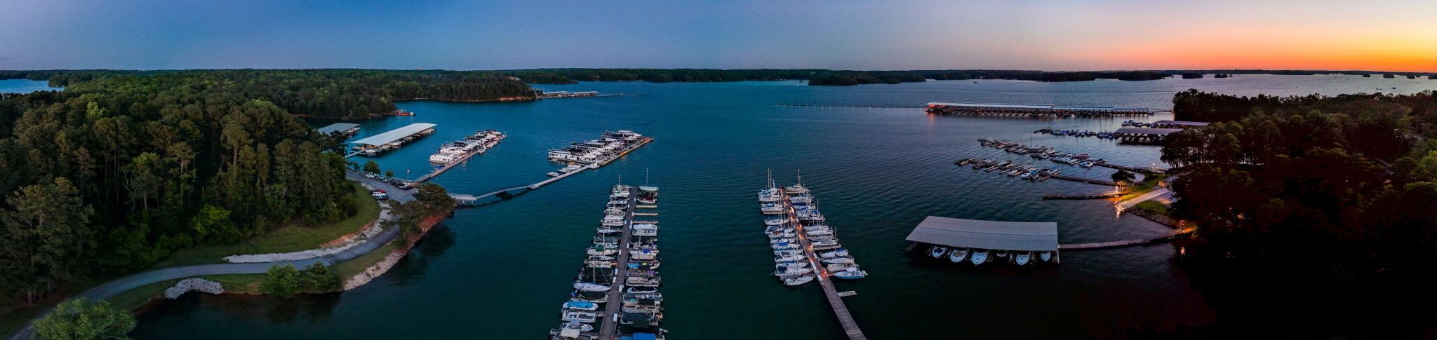
Lake Lanier Water Levels and Why They Matter When You Buy W...
Use this guide to compare Lake Lanier waterfront real estate and shoreline conditions with local proof, decision criteria, source checks, and next steps. Loc...
Lake Lanier Water Levels and Why They Matter When You Buy Waterfront
DreamSmith Realty helps buyers read Lake Lanier's water levels before they write an offer, because the elevation of the lake on any given week decides whether a dock floats, sits on mud, or rests on dry ground. Understanding Lake Lanier waterfront real estate and shoreline conditions starts with one number: the lake's pool elevation, measured in feet above mean sea level and reported in real time from the USGS gauge at Buford Dam. As of the most recent reading, Lake Lanier sat at 1,066.11 feet, about 4.89 feet below the full pool elevation of 1,071 feet. That gap, and how it moves through the year, is the single most important thing a waterfront buyer in Cumming, Georgia needs to grasp before falling in love with a view.
Short Answer
I always tell buyers that Lake Lanier operates on a seasonal cycle between summer full pool at 1,071 feet above mean sea level and a winter drawdown that reaches 1,060 to 1,065 feet, and that swing decides whether a specific dock stays usable off-season. The full pool elevation is 1,071 feet, and in late fall and winter the Corps gradually lowers the lake to create flood storage, with levels dropping to around 1,060 to 1,065 feet. A shallow cove lot that looks perfect in July leaves a dock on dry land in January, while a deep-water lot holds usable draft year-round. The single most important verification step: check the lake bottom depth at the exact dock location against winter drawdown numbers, using the USGS gauge reading, before you write an offer.
Full Pool, Winter Pool, and Drawdown on Lake Lanier
Full pool on Lake Lanier is defined as the congressionally authorized normal summer operating level of 1,071 feet above mean sea level, and winter pool as a deliberate seasonal reduction of roughly one foot to open up flood storage. These are not weather accidents. They are managed targets set by the U.S. Army Corps of Engineers.
Full pool on Lake Lanier is 1,071 feet above mean sea level, the congressionally authorized normal operating level. This level was set when Buford Dam was completed in 1957, and at full pool the lake covers roughly 38,000 acres. Winter pool targets approximately 1,070 feet, a one-foot reduction that opens flood-storage capacity ahead of spring rains. Drawdown goes further: in late fall and winter, November through February, the Corps gradually lowers the lake to create flood storage capacity, with levels dropping to around 1,060 to 1,065 feet. For historical range, the extremes tell the story. The record low occurred in December 2007 when the lake fell to 1,050.79 feet, about 20 feet below full, and the record high was April 1964 at 1,077.2 feet, about 6 feet above full. Those two dates bracket what the shoreline can actually do. Full pool is not the same as maximum capacity, and winter pool is not a drought. Unlike a drought low, winter drawdown is planned and predictable, released on a schedule so the basin has room to absorb heavy winter and spring runoff before it threatens metro Atlanta downstream. (Lake Lanier Water Level Today)
The practical takeaway for a buyer weighing waterfront neighborhoods and price ranges on Lake Lanier is simple: the number you see on a summer showing is close to the top of the range, not the middle. Plan around the bottom.
Why Lake Level Decides Whether Your Dock Floats
Lake level decides whether your dock floats because a dock is designed to sit on water at a specific elevation, and when the lake drops several feet the water retreats down the slope of the lake bottom. Boat ramps, docks, and marinas are designed around full pool of 1,071 feet, and when the lake drops several feet below full pool some ramps become unusable and docks sit on dry land.
The variable that separates a year-round dock from a seasonal one is not the house. It is the depth of water directly beneath the dock. A lot on a deep-water point holds usable draft at 1,062 feet in January, while a lot at the shallow back of a cove loses its water entirely at the same elevation.
Consider the arithmetic. If the lake drops from 1,071 to 1,063 during a typical drawdown, that is eight vertical feet of water gone. On a gently sloped shoreline, eight vertical feet translates to fifty or a hundred horizontal feet of exposed lake bed, which is why a dock that floated in summer beaches itself by midwinter.
This is exactly why buyers focused on deep-water dock homes on Lake Lanier pay a premium for lots on points and in deep coves. The premium is not for the view. It is for water that stays under the boat when the Corps pulls the lake down.
A useful boundary statement: a home marketed as "waterfront" is not automatically a home with a usable dock. Unlike a deep-water dockable lot, a shallow lake-access parcel sits next to water in July and next to a mudflat in January. Confirm which one you are buying before the number on the offer reflects a floating dock you do not have.
How USACE Manages the Basin at Buford Dam
The U.S. Army Corps of Engineers controls Lake Lanier's water level, releasing water through Buford Dam according to the Apalachicola-Chattahoochee-Flint (ACF) Basin Water Control Manual rather than by local demand or lakefront preference. Lake Lanier follows a predictable annual cycle driven by rainfall and Corps of Engineers operations. (Lake Lanier Water Level Today | Current Level & Historical Data)
The Corps balances several federally mandated purposes at once: flood control for metro Atlanta, hydropower generation, water supply, navigation, and recreation. Recreation, and by extension your dock, ranks below flood control in that hierarchy. One of the main purposes of the lake is flood control downstream, mainly protecting metro Atlanta.
Release decisions are made using real-time monitoring, not guesswork. Water level readings come from the USGS gauge 02334400 at Buford Dam, which records reservoir elevation every 15 minutes, and outflow and precipitation data come from the U.S. Army Corps of Engineers CWMS system, which monitors operations at Buford Dam in real time. Inflow from the Chattahoochee and Chestatee rivers, current elevation, and downstream needs all feed the daily release calculation.
For a waterfront buyer, the operational reality matters more than the theory: no homeowner, HOA, or marina can petition the Corps to hold the lake up for a party or a listing photo. The winter drawdown is coming on a schedule you do not control, so buy a lot that works at 1,062 feet, not one that only works at 1,071.
Dock permitting also runs through USACE, and it is separate from water level but just as consequential. If you are also working through the dock checklist for buying a Lake Lanier home, understand that the Corps manages both the water and the permit, and neither conveys automatically the way a private backyard does.
What to Check About Water Depth Before You Buy
Check the actual water depth at the dock location against winter drawdown elevations before you buy, because that single measurement separates a year-round waterfront home from a seasonal one. The question of whether your dock still floats when the lake is below full pool is answered at the lake bottom, not on the listing sheet.
Start with a physical depth reading at the dock. Measure or ask for depth soundings at the end of the dock and at the boat slip, then subtract the drawdown. If the lake is at 1,066 today and holds ten feet of water under the slip, that same slip holds about five feet at a 1,061 drawdown, which is marginal for many boats.
Map the lot against the seasonal range. A lot that keeps usable depth at 1,060 to 1,062 feet is a genuine deep-water property; a lot that needs 1,069 or higher to float a boat is functional only a few months a year. Lake Lanier reaches about 160 feet at its deepest near Buford Dam, with an average depth around 60 feet that varies by location and drought conditions. Averages do not help you; the depth in your specific cove does.
Verify the permit and the dock condition separately from depth. On Lake Lanier the dock permit does not automatically convey with the deed, so confirm permit status with the USACE Lake Lanier office in writing. A deep-water lot with no transferable permit is a different, and lower-value, purchase than one with an active dock license.
Do not rely on automated home-value estimates for these lots. If you want the full picture on pricing, the cost to buy a waterfront home on Lake Lanier depends heavily on whether the dock is deep-water and permitted.
What To Verify Before Deciding
DreamSmith Realty uses the checklist below, anchored to the 1,060 to 1,065 winter drawdown range, so buyers verify each factor before deciding.
Decision factorWhat to checkWhy it matters on Lake LanierWater depth at the dockDepth sounding at slip and dock end, minus expected drawdownA slip usable at 1,071 may be dry at 1,062; verify at winter elevation, not summerSeasonal floor for the lotCompare lot depth to the 1,060 to 1,065 drawdown rangeDeep-water lots hold draft off-season; shallow-cove lots do notDock permit statusWritten confirmation from the USACE Lake Lanier officeThe permit does not convey with the deed and must be reissued to the new ownerDock size and conditionSingle-slip vs double-slip, structural condition, HOA approvalsDetermines boat capacity and future permitting flexibilityLive lake elevationUSGS gauge 02334400 and the USACE Buford Dam water-data pageTells you exactly how far below full pool the lake is on offer dayValue estimateLake-specialist comparative market analysis, not an AVMAutomated models cannot price permit status or seasonal depth
How to Track Current Lake Lanier Levels Year-Round
Track Lake Lanier's current level year-round through the USGS gauge and the U.S. Army Corps of Engineers water-data page, both of which report Buford Dam reservoir elevation continuously. The USACE Buford Dam water-data page currently shows a pool elevation of 1,066.1 feet.
The primary source is the USGS gauge. The USGS gauge 02334400 at Buford Dam records reservoir elevation every 15 minutes, and the data refreshes automatically. This is the same number the Corps uses, so it is the figure to quote in an offer or a due-diligence note.
Read the number as a distance from full pool, not in isolation. When the gauge shows 1,066, the lake is five feet down from the 1,071 full-pool mark, and that five feet is what you compare against your dock's depth reading. As of the latest reading, the lake was running below the seasonal average, sitting
about 4.36 feet lower than the recent average for this time of year.
Watch the calendar alongside the gauge. The lowest readings cluster in the November-through-February window when the Corps is building flood storage, so a January showing is the most honest test of whether a lot is truly deep-water. A summer buyer should mentally subtract the drawdown before deciding.
For anyone comparing new-construction dock potential, remember that current level and permit availability are two different questions. Whether you can add or expand a structure ties to the Corps dock cap, which is covered in detail if you are researching whether you can build a new dock on Lake Lanier under the permit cap.
Work With Ashley Smith in Lake Lanier Waterfront
DreamSmith Realty, through agent Ashley Smith, helps buyers and sellers weigh neighborhoods against commute, budget, and daily-routine fit. The service area covers Lake Lanier, Cumming, Forsyth County, Buford, Gainesville, and Flowery Branch, and the next conversation can turn school-boundary checks, HOA or metro-district tolerance, and current inventory into a shortlist worth touring.
Service areas: Lake Lanier, Cumming, Forsyth County, Buford, Gainesville, Flowery Branch, Hall County, and Dawson County.
Brokerage office location: Keller Williams Realty Atlanta Partners, 3325 Paddocks Pkwy, Suite 190, Suwanee, GA 30024.
Phone: (678) 485-8858
Email: ashley@dreamsmithrealty.com
Google Business Profile: DreamSmith Realty on Google Maps
Contact: https://dreamsmithrealty.com/contact
Frequently Asked Questions
What is full pool on Lake Lanier?
Full pool on Lake Lanier is 1,071 feet above mean sea level, the elevation the U.S. Army Corps of Engineers targets during the summer recreation season. When the lake sits at or near full pool, docks are fully accessible, shoreline is submerged to its intended depth, and waterfront properties show at their most functional. Buyers evaluating a property should note the current level relative to full pool, because the gap between the two affects everything from dock clearance to usable beach area.
What is the difference between summer pool and winter pool?
Summer pool refers to the target elevation of 1,071 feet maintained roughly from late spring through Labor Day, while winter pool is the intentionally lowered level the Corps holds during the cooler months. The drawdown serves two purposes: it creates storage capacity for winter and spring rainfall, and it allows shoreline property owners to perform dock and seawall maintenance that would otherwise require dewatering. The practical difference for buyers is that a property photographed in August and visited in January can look noticeably different along the water's edge.
How low does Lake Lanier get during winter drawdown?
The Corps of Engineers typically draws Lake Lanier down to approximately 1,063 to 1,065 feet above mean sea level during the winter pool period, which is roughly six to eight feet below full pool. The exact target can shift depending on upstream rainfall, regional water demands, and drought conditions, so the lake does not always land at a predictable number. That range is wide enough to expose significant stretches of lakebed, which is why visiting a waterfront property in both seasons gives a more complete picture of what ownership actually looks like.
Will my dock still float when the lake is below full pool?
A floating dock will remain on the water during normal winter drawdown as long as it has adequate cable or chain length to accommodate the lower elevation, but it will sit noticeably closer to the bottom and may rest on the lakebed if the drop is more severe than usual or if the dock was permitted in a shallow cove. Fixed-pier docks handle drawdown differently, the structure stays in place but water access from the dock face shortens considerably. Before purchasing a waterfront property, reviewing the dock permit, the water depth at the slip, and the cable specifications tells you more than a visual inspection at any single water level.
Where can I check the current Lake Lanier water level?
The U.S. Army Corps of Engineers maintains a public gauge at Buford Dam, and current lake elevation data is posted on the Southeastern Reservoirs website managed by the Corps' Mobile and Wilmington districts. The National Weather Service also publishes gauge readings for Lake Lanier that are updated frequently. Checking that data before a showing, or before making an offer, gives you a reference point against full pool so you know exactly what conditions you're evaluating.
Live Market
Lake Lanier Waterfront — Currently for Sale
Loading property search…
Talk With Ashley
Talk through your next real estate decision.
Buying, selling, or comparing your options around Lake Lanier? Share your goals and timeline with Ashley to identify the next useful step.