
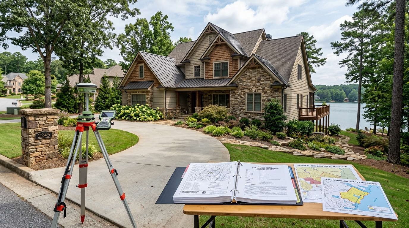
Forsyth County Address-Level Due-Diligence Checklist for Buyers
Before buying a specific home in Forsyth County, build one address-level evidence file keyed to the exact street address, unit if applicable, parcel ID, legal description, owner re
Before buying a specific home in Forsyth County, build one address-level evidence file keyed to the exact street address, unit if applicable, parcel ID, legal description, owner record, governing jurisdiction, signed contract, and every due-diligence deadline. Use it to reconcile Forsyth County parcel and assessment fields, base zoning, overlays, effective FEMA flood-map components, and the qualified follow-up each unresolved issue requires before the contractual protection expires. A Forsyth County street address alone may not identify the exact tax parcel, condominium unit, legal property, owner record, governing city or county jurisdiction, zoning feature, overlay, or flood-map feature. Match the street address, unit, parcel ID, legal description, owner record, jurisdiction, and effective map identifiers before joining official records. The Georgia Attorney General page is consumer guidance, not the subject property's completed and signed purchase contract, addendum, amendment, notice, or legal advice. Read the executed contract, selected contingencies, filled deadlines, notice and delivery terms, amendments, and written extensions with responsible Georgia professionals before relying on a right or consequence. The official sources do not establish a universal Georgia or Forsyth County due-diligence period, inspection scope, cancellation right, waiver result, extension, or earnest-money outcome. Calendar and satisfy the exact contract before its deadlines; do not assume an oral extension or generic checklist changes the signed terms. Tax parcel and assessment data do not prove title, boundaries, ownership interests, liens, easements, legal description, current condition, completed improvements, permits, appraisal, market value, or transaction price. Use current deeds and recorded instruments plus qualified title, legal, survey, inspection, appraisal, and tax review for each corresponding question. A mapped base-zoning classification does not prove governing jurisdiction, legal use, nonconforming status, conditions, variances, overlays, setbacks, development rights, or approval for proposed work. Confirm the exact parcel, jurisdiction, current zoning record, UDC or city code, prior approvals, conditions, overlays, and proposed use or alteration with the responsible planning authority and qualified professionals. An overlay map screen does not establish the exact boundary, every applicable standard, an exemption, a conflict resolution, permit approval, or a site-specific environmental conclusion. Open the current governing code and official parcel-level record, verify boundaries and standards with the responsible authority, and obtain survey, engineering, environmental, or legal review where needed. FEMA flood layers are screens rather than a parcel survey, elevation certificate, current map determination, insurance quote, lender decision, safety guarantee, or prediction of flooding. Verify the effective FIRM panel, zone, amendments or revisions, elevation evidence, lender and insurer requirements, and site-specific professional findings for the exact property. The evidence contains no subject-property contract, title, survey, condition, permit, zoning, overlay, flood, insurance, lender, tax, appraisal, or transaction conclusion and no client-specific fact. Resolve the exact property with current records and qualified professionals, and do not invent any DreamSmith Realty performance, credential, representation, transaction, due-diligence success, or Forsyth County-specific local-experience claim.
Lock the address, unit, parcel, legal description, and jurisdiction
Start this step with the exact identifiers named in the sealed checklist. Keep one dated evidence file, label the resolution of every record, and preserve any mismatch as an open question rather than forcing records together. This makes the forsyth county address-level due-diligence guide for buyers usable by the buyer, attorney, title professional, inspector, and other responsible parties without inventing a property conclusion.
Verified evidence for this step
- Verified official finding: Georgia's Department of Revenue provides county property-record links and says county Boards of Tax Assessors are responsible for property valuation assessments; these records are a starting point for parcel matching rather than a substitute for transaction due diligence. Source: Property Records Online.
- Verified official finding: Forsyth County describes its Tax Parcel feature layer as a nightly-updated published representation of real-property areas combined with assessing and tax information and warns through its data design that multiple condominium units can share redundant parcel geometry. Source: Tax Parcel public feature layer.
- Verified official finding: The Forsyth County Tax Parcel layer exposes matching and screening fields including parcel ID, site address, subdivision or condominium name, building and residential area, year built, structure type, stated area, zoning, tax year, assessment values, and property or tax links. Source: Tax Parcel public feature layer.
Verify before moving on
Record the exact match key, official system, underlying document, displayed date or status, unresolved limitation, responsible follow-up owner, and applicable contract deadline. Ask the qualified agency or professional named by the evidence to resolve material gaps. Do not convert a public-record hit, map screen, form, or index result into a property-specific legal, physical, financial, insurance, title, or transaction conclusion.
Map every check to the signed Georgia contract and deadline
Work from the exact property identifiers, signed documents, and deadlines already established in the evidence file. Open the underlying official record, save its date and identifier, and separate what the record can show from the decision it cannot make.
Verified evidence for this step
- Verified official finding: Georgia Attorney General consumer guidance says that an accepted offer is binding and advises including a home-inspection or financing contingency to preserve a way out, while the executed contract must supply the exact protection and deadline. Source: Making an Offer.
- Verified official finding: A defensible address-level file therefore joins the exact address and unit to the parcel and tax year, screens base zoning and overlays in the correct jurisdiction, checks current FEMA map components, and maps every unresolved issue to the signed contract and responsible professional before the contingency expires. Source: Making an Offer and Property Records Online and Tax Parcel public feature layer and Zoning Districts public feature layer and Overlay Districts public map layer and National Flood Hazard Layer map service.
Verify before moving on
Record the exact match key, official system, underlying document, displayed date or status, unresolved limitation, responsible follow-up owner, and applicable contract deadline. Ask the qualified agency or professional named by the evidence to resolve material gaps. Do not convert a public-record hit, map screen, form, or index result into a property-specific legal, physical, financial, insurance, title, or transaction conclusion.
Separate tax-parcel facts from title, survey, condition, and value
Work from the exact property identifiers, signed documents, and deadlines already established in the evidence file. Open the underlying official record, save its date and identifier, and separate what the record can show from the decision it cannot make.
Verified evidence for this step
- Verified official finding: Georgia's Department of Revenue provides county property-record links and says county Boards of Tax Assessors are responsible for property valuation assessments; these records are a starting point for parcel matching rather than a substitute for transaction due diligence. Source: Property Records Online.
- Verified official finding: Forsyth County describes its Tax Parcel feature layer as a nightly-updated published representation of real-property areas combined with assessing and tax information and warns through its data design that multiple condominium units can share redundant parcel geometry. Source: Tax Parcel public feature layer.
- Verified official finding: The Forsyth County Tax Parcel layer exposes matching and screening fields including parcel ID, site address, subdivision or condominium name, building and residential area, year built, structure type, stated area, zoning, tax year, assessment values, and property or tax links. Source: Tax Parcel public feature layer.
Verify before moving on
Record the exact match key, official system, underlying document, displayed date or status, unresolved limitation, responsible follow-up owner, and applicable contract deadline. Ask the qualified agency or professional named by the evidence to resolve material gaps. Do not convert a public-record hit, map screen, form, or index result into a property-specific legal, physical, financial, insurance, title, or transaction conclusion.
Verify base zoning in the governing jurisdiction
Work from the exact property identifiers, signed documents, and deadlines already established in the evidence file. Open the underlying official record, save its date and identifier, and separate what the record can show from the decision it cannot make.
Verified evidence for this step
- Verified official finding: Forsyth County's public Zoning Districts layer exposes mapped zoning classification and description fields that can identify a candidate district for exact-jurisdiction follow-up. Source: Zoning Districts public feature layer.
- Verified official finding: A defensible address-level file therefore joins the exact address and unit to the parcel and tax year, screens base zoning and overlays in the correct jurisdiction, checks current FEMA map components, and maps every unresolved issue to the signed contract and responsible professional before the contingency expires. Source: Making an Offer and Property Records Online and Tax Parcel public feature layer and Zoning Districts public feature layer and Overlay Districts public map layer and National Flood Hazard Layer map service.
Verify before moving on
Record the exact match key, official system, underlying document, displayed date or status, unresolved limitation, responsible follow-up owner, and applicable contract deadline. Ask the qualified agency or professional named by the evidence to resolve material gaps. Do not convert a public-record hit, map screen, form, or index result into a property-specific legal, physical, financial, insurance, title, or transaction conclusion.
Screen overlays and open the governing standards
Work from the exact property identifiers, signed documents, and deadlines already established in the evidence file. Open the underlying official record, save its date and identifier, and separate what the record can show from the decision it cannot make.
Verified evidence for this step
- Verified official finding: Forsyth County's Overlay Districts layer describes multiple county overlays and explains for several overlays that their regulations apply in addition to base zoning and can control when the standards expressly conflict. Source: Overlay Districts public map layer.
- Verified official finding: A defensible address-level file therefore joins the exact address and unit to the parcel and tax year, screens base zoning and overlays in the correct jurisdiction, checks current FEMA map components, and maps every unresolved issue to the signed contract and responsible professional before the contingency expires. Source: Making an Offer and Property Records Online and Tax Parcel public feature layer and Zoning Districts public feature layer and Overlay Districts public map layer and National Flood Hazard Layer map service.
Verify before moving on
Record the exact match key, official system, underlying document, displayed date or status, unresolved limitation, responsible follow-up owner, and applicable contract deadline. Ask the qualified agency or professional named by the evidence to resolve material gaps. Do not convert a public-record hit, map screen, form, or index result into a property-specific legal, physical, financial, insurance, title, or transaction conclusion.
Check effective FEMA map components and assign follow-up
Work from the exact property identifiers, signed documents, and deadlines already established in the evidence file. Open the underlying official record, save its date and identifier, and separate what the record can show from the decision it cannot make.
Verified evidence for this step
- Verified official finding: FEMA's National Flood Hazard Layer service provides official map layers for NFHL availability, FIRM panels, Letters of Map Revision and Amendment, base flood elevations, flood-hazard boundaries, and flood-hazard zones for parcel-specific map follow-up. Source: National Flood Hazard Layer map service.
- Verified official finding: A defensible address-level file therefore joins the exact address and unit to the parcel and tax year, screens base zoning and overlays in the correct jurisdiction, checks current FEMA map components, and maps every unresolved issue to the signed contract and responsible professional before the contingency expires. Source: Making an Offer and Property Records Online and Tax Parcel public feature layer and Zoning Districts public feature layer and Overlay Districts public map layer and National Flood Hazard Layer map service.
Verify before moving on
Record the exact match key, official system, underlying document, displayed date or status, unresolved limitation, responsible follow-up owner, and applicable contract deadline. Ask the qualified agency or professional named by the evidence to resolve material gaps. Do not convert a public-record hit, map screen, form, or index result into a property-specific legal, physical, financial, insurance, title, or transaction conclusion.
For separate transaction decisions, use Cumming address-level due-diligence checklist, Cumming inspection-contingency guide, Cumming comparable-sales guide, Cumming listing-agreement guide. Those resources answer different questions and do not change this exact-address checklist, the signed contract, or its evidence limits.
Forsyth County address-level due-diligence record matrix
| Record check | Exact match key | Official system | What it can show | What it cannot prove | Follow-up owner |
|---|---|---|---|---|---|
| Identity and contract | Address, unit, parcel ID, legal description, jurisdiction, signed contract, and deadlines | Georgia consumer guidance plus executed transaction file | Need for written contingency protection and the property's controlling identifiers | Any actual right, deadline, cancellation, waiver, extension, or earnest-money result from generic guidance | Buyer, broker, Georgia attorney, title professional, and surveyor |
| Tax parcel and assessment | Exact parcel, address, unit or condo name, tax year, record links, and legal record | Georgia DOR and Forsyth County Tax Parcel layer | Parcel identifiers, selected building fields, zoning field, assessment and tax context | Title, boundaries, condition, improvements, permits, appraisal, market value, or sale terms | Assessor, title professional, surveyor, inspector, appraiser, and attorney |
| Base zoning | Exact parcel geometry, governing jurisdiction, classification, description, and effective record | Forsyth County Zoning Districts layer plus responsible planning authority | Candidate mapped zoning classification and description | Legal use, conditions, variances, overlays, setbacks, or approval for proposed work | City or county planning staff, surveyor, architect, and land-use attorney |
| Overlay standards | Exact parcel geometry, district, official boundary, governing code, and proposed use or work | Forsyth County Overlay Districts layer and current governing code | Candidate overlay and described relationship to base zoning | Exact boundary, complete standards, exemption, approval, or site conclusion | Planning authority, surveyor, engineer, environmental professional, and attorney |
| Flood-map follow-up | Exact parcel, effective FIRM panel, zone, LOMA or LOMR, base elevation, insurance and lender file | FEMA NFHL plus transaction-specific professionals | Official map components requiring exact-property review | Surveyed elevation, insurance cost or coverage, lender decision, safety, or future flooding | Surveyor, floodplain official, insurer, lender, engineer, and attorney |
Use the matrix as a routing and deadline tool. It does not supply a property-specific conclusion. Mark each row verified, unresolved, or not applicable, and preserve who is responsible for the next action. Once the exact evidence file is organized, use the contact page to request a review anchored to those records.
Official sources used in this guide
- Making an Offer — Georgia Attorney General Consumer Protection Division
- Property Records Online — Georgia Department of Revenue
- Tax Parcel public feature layer — Forsyth County GIS
- Zoning Districts public feature layer — Forsyth County GIS
- Overlay Districts public map layer — Forsyth County GIS
- National Flood Hazard Layer map service — Federal Emergency Management Agency
These sources establish only the claims and limitations in the sealed ledger. Their inclusion does not establish facts about a subject property or the client.
Frequently asked questions
Does a Forsyth County address identify the exact property for due diligence?
Not by itself. Match the address and unit to the parcel ID, legal description, owner record, governing jurisdiction, zoning and overlay features, and effective FEMA map identifiers before joining results.
Does Forsyth County assessed value show what the home is worth?
No. Assessment is a tax metric. The parcel layer can help match facts, but it does not prove appraised value, market value, transaction price, condition, title, boundaries, or completed improvements.
Does the zoning map prove a proposed use or renovation is allowed?
No. Confirm jurisdiction, current base zoning, overlays, conditions, prior approvals, governing code, and the proposed use or work with the responsible planning authority and qualified professionals.
Does a FEMA flood-zone screen settle insurance or lender requirements?
No. Verify the effective FIRM panel, zone, amendments or revisions, elevation evidence, and the actual lender and insurer requirements for the exact parcel.
Live Market
Currently for Sale in Cumming, GA
Talk With Ashley
The best conversations happen well before you’re ready to list.
Whether you’re years from selling or weeks away, a quick call is the fastest way to figure out what your home is really worth and how to position it. Reach out anytime — direct line below.